

How 3D scanning improves accuracy and saves time in field surveys
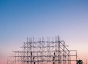
Photo by Igor Starkov
Accuracy and efficiency are critical in construction field surveys. Traditional survey methods can be time-consuming and often rely on manual measurements, which leaves room for human error. In a fast-paced industry where decisions depend on reliable data, construction firms need tools that offer precision without sacrificing time. One powerful solution gaining traction is 3D scanning. It captures detailed site information quickly, allowing for a more streamlined survey process. This cutting-edge method falls under the broader category known as Reality Capture, which refers to technologies that document physical spaces digitally for use in design and construction workflows.
Reducing human error in data collection
Measurement errors in field surveys can lead to costly project delays and rework. 3D scanning technology minimizes these risks by capturing millions of data points within seconds. The scanner records site dimensions with exceptional detail, offering a far more complete and accurate picture than manual tape measurements or traditional total stations.
Once the scanner collects this data, it produces a point cloud, which is a dense collection of spatial coordinates. Surveyors can then generate highly detailed 3D models or digital twins from these point clouds. Because these models reflect actual site conditions with exact proportions, the margin for error drops significantly. As a result, project managers can rely on the data for confident decision-making, reducing change orders and miscommunication between trades.
Saving time with automated site documentation
Speed matters on job sites, especially when crews operate under tight deadlines. With 3D scanning, what used to take hours or days now takes minutes. A technician can scan an entire construction site in a single session, capturing comprehensive data without interrupting ongoing work. Unlike manual methods, which often require return visits to collect missed measurements, 3D scanning gets it right the first time.
The automation also improves documentation accuracy. Each scan produces a digital record that remains accessible throughout the project lifecycle. Engineers, architects, and contractors can reference the same dataset remotely, avoiding the need to send teams back to the site for clarification. That’s a huge time saver, especially on large or complex builds where coordination is key.
Key benefits for construction firms
Construction companies exploring new technologies often look for clear benefits before making a change. 3D scanning offers several advantages that align with daily fieldwork needs:
- Improved safety: Surveyors can capture hazardous or hard-to-reach areas without entering them physically.
- Faster planning: Project teams can begin design work sooner using accurate as-built models.
- Better coordination: All stakeholders access the same visual and dimensional data, improving collaboration.
- Enhanced documentation: Scans create an objective site record that can help resolve disputes or verify completed work.
- Reduced rework: Fewer surprises during construction means fewer adjustments and less waste.
These practical benefits show why so many firms are adopting this technology, not just as a novelty but as a core part of their workflow.
Streamlining renovations and retrofit projects
Renovation projects bring unique challenges. Original drawings often don’t reflect current conditions, and structures may have shifted or changed since initial construction. 3D scanning offers an efficient way to assess what’s truly there before demolition begins.
The scanner captures current conditions without relying on old plans or assumptions. Whether it’s a historic building with undocumented additions or a commercial site requiring code upgrades, the technology gives teams the accurate foundation they need to plan confidently. It also helps prevent costly surprises during construction by revealing misalignments, hidden obstacles, or irregular surfaces in advance.
Supporting better project communication
Clear communication between field crews, designers, and owners plays a major role in a project’s success. Misunderstandings often stem from inconsistent documentation or outdated drawings. 3D scanning creates a unified source of truth everyone can see.
Teams can share visual data directly with stakeholders using 3D viewers or BIM platforms. This helps non-technical team members understand design intent and existing conditions more clearly. Better visualization leads to fewer misunderstandings and quicker approvals. It also aids in training and planning, as crew members can visualize jobsite elements before stepping foot on-site.
Take your field surveys to the next level
Construction firms looking to improve efficiency and accuracy should consider investing in 3D scanning technology. It’s not just a tool for high-tech firms; it’s a practical solution with measurable benefits for projects of all sizes. By leveraging Reality Capture, you gain clearer insights, save valuable time, and deliver more consistent results. Ready to upgrade your field survey process? Start exploring 3D scanning solutions tailored to your projects and unlock the full potential of your site data.